icon-dot-gov
Official websites use .gov
A .gov website belongs to an official government organization in the United States.
icon-https
Secure .gov websites use HTTPS
A lock ( Lock A locked padlock ) or https:// means you’ve safely connected to the .gov website. Share sensitive information only on official, secure websites.
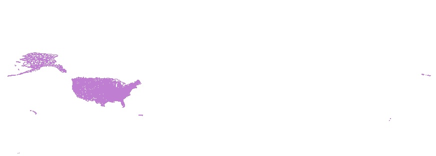
Spatial Extent of Data
+−
Leaflet | U.S. Department of the Interior | U.S. Geological Survey | Policies
USGS Data Source
National Geospatial Technical Operations Center
ISO 19115 Topic Category
Other Subject Keywords
HU6, Water Inland Theme, National Geospatial Data Asset, WBD, NGDA, HU2, HUC, drainage systems and characteristics, Watershed Boundaries, Hydrologic Region, Hydrologic Unit, HU10, HU, Boundary, Hydrologic Unit Code, Administrative watershed units, HU16, Hydrologic Subregion, Drainage areas for surface water, HU8, HU4, Watershed, NGDAID163, Hydrography, Watershed Boundary Dataset, HU14, Drainage area, HU12, Topographic
Place Keywords
Watershed Boundary Dataset (WBD) - USGS National Map Downloadable Data Collection
The Watershed Boundary Dataset (WBD) is a comprehensive aggregated collection of hydrologic unit data consistent with the national criteria for delineation and resolution. It defines the areal extent of surface water drainage to a point except in coastal or lake front areas where there could be multiple outlets as stated by the "Federal Standards and Procedures for the National Watershed Boundary Dataset (WBD)"(https://pubs.usgs.gov/tm/11/a3/). Watershed boundaries are determined solely upon science-based hydrologic principles, not favoring any administrative boundaries or special projects, nor particular program or agency. This dataset represents the hydrologic unit boundaries to the 12-digit for the entire United States. Some areas may also include additional subdivisions representing the 14- and 16-digit hydrologic unit (HU). At a minimum, the HUs are delineated at 1:24,000-scale in the conterminous United States, 1:25,000-scale in Hawaii, Pacific basin and the Caribbean, and 1:63,360-scale in Alaska, meeting the National Map Accuracy Standards (NMAS). Higher resolution boundaries were developed where partners and data existed and were incorporated back into the WBD. WBD data are delivered as a dataset of polygons and corresponding lines that define the boundary of the polygon. WBD polygon attributes include hydrologic unit codes (HUC), size (in the form of acres and square kilometers), name, downstream hydrologic unit code, type of watershed, non-contributing areas, and flow modifications. The HUC describes where the unit is in the country and the level of the unit. WBD line attributes contain the highest level of hydrologic unit for each boundary, line source information and flow modifications. For additional information on NHD, go to https://www.usgs.gov/national-hydrography.
| Author(s) | Geological Survey U.S. |
| --- | --- |
| Publication Date | 2025 |
| Beginning Date of Data | 1980 |
| Ending Date of Data | present |
| Data Contact | U.S. Geological Survey Click to copy the email address! |
| DOI | This item doesn't have a registered DOI. |
| Citation | Check repository for data citation. Click to copy the citation! |
| Metadata Contact | U.S. Geological Survey, National Geospatial Technical Operations Center Click to copy the email address! |
| Metadata Date | 2025-02-28 |
| Related Publication | There was no related primary publication associated with this data release. |
| Citations of these data | No citations of these data are known at this time. |
| Access | public |
| License | http://www.usa.gov/publicdomain/label/1.0/ |
Harvest Source: ScienceBase
Harvest Date: 2025-09-03T05:06:04.692Z
Watershed Boundary Dataset (WBD) - USGS National Map Downloadable Data Collection
CSDGM Metadata:
- Identification_Information
- Data_Quality_Information
- Spatial_Data_Organization_Information
- Spatial_Reference_Information
- Distribution_Information
- Metadata_Reference_Information
Identification_Information:
Citation:
Citation_Information:
Originator: U.S. Geological Survey, National Geospatial Technical Operations Center
Publication_Date: 2023
Title: Watershed Boundary Dataset (WBD) - USGS National Map Downloadable Data Collection
Geospatial_Data_Presentation_Form: vector digital data
Publication_Information:
Publication_Place: Reston, VA
Publisher: U.S. Geological Survey
Online_Linkage:https://www.usgs.gov/national-hydrography
Online_Linkage:https://www.usgs.gov/the-national-map-data-delivery
Larger_Work_Citation:
Citation_Information:
Originator: U.S. Geological Survey
Publication_Date: 2023
Title: National Watershed Boundary Dataset (WBD)
Online_Linkage:https://www.sciencebase.gov/catalog/item/51361e87e4b03b8ec4025c22
Description:
Abstract: The Watershed Boundary Dataset (WBD) is a comprehensive aggregated collection of hydrologic unit data consistent with the national criteria for delineation and resolution. It defines the areal extent of surface water drainage to a point except in coastal or lake front areas where there could be multiple outlets as stated by the "Federal Standards and Procedures for the National Watershed Boundary Dataset (WBD)" "Standard" (https://pubs.usgs.gov/tm/11/a3/). Watershed boundaries are determined solely upon science-based hydrologic principles, not favoring any administrative boundaries or special projects, nor particular program or agency. This dataset represents the hydrologic unit boundaries to the 12-digit for the entire United States. Some areas may also include additional subdivisions representing the 14- and 16-digit hydrologic unit (HU). At a minimum, the HUs are delineated at 1:24,000-scale in the conterminous United States, 1:25,000-scale in Hawaii, Pacific basin and the Caribbean, and 1:63,360-scale in Alaska, meeting the National Map Accuracy Standards (NMAS). Higher resolution boundaries are being developed where partners and data exist and will be incorporated back into the WBD. WBD data are delivered as a dataset of polygons and corresponding lines that define the boundary of the polygon. WBD polygon attributes include hydrologic unit codes (HUC), size (in the form of acres and square kilometers), name, downstream hydrologic unit code, type of watershed, non-contributing areas, and flow modifications. The HUC describes where the unit is in the country and the level of the unit. WBD line attributes contain the highest level of hydrologic unit for each boundary, line source information and flow modifications. For additional information on NHD, go to https://www.usgs.gov/national-hydrography.
Purpose: The intent of defining Hydrologic Units (HU) within the Watershed Boundary Dataset is to establish a base-line drainage boundary framework, accounting for all land and surface areas. Hydrologic units are intended to be used as a tool for water-resource management and planning activities particularly for site-specific and localized studies requiring a level of detail provided by large-scale map information. The WBD complements the National Hydrography Dataset (NHD) and supports numerous programmatic missions and activities including: watershed management, rehabilitation and enhancement, aquatic species conservation strategies, flood plain management and flood prevention, water-quality initiatives and programs, dam safety programs, fire assessment and management, resource inventory and assessment, water data analysis and water census. Further information and data download are available at https://www.usgs.gov/national-hydrography
Supplemental_Information: The WBD was produced and is maintained through a cooperative process involving state, federal and local partners. Process information for a specific state or region can be found within the state specific metadata located at https://www.usgs.gov/national-hydrography/wbd-fgdc-historical-state-metadata-archive. The WBD national FGDC metadata file has information for WBD features contained in the WBD feature dataset. This includes information about the 2-, 4-, 6-, 8-, 10-, 12-, 14-, 16-digit polygons and WBD_Line dataset, and can be accessed at https://prd-tnm.s3.amazonaws.com/StagedProducts/Hydrography/WBD/National/GDB/WBD_National_GDB.xml. Users accessing the WBD via shapefile will need to search for the attribution related to that specific dataset because the field headers are truncated in shapefile format.
Time_Period_of_Content:
Time_Period_Information:
Range_of_Dates/Times:
Beginning_Date: 1980
Ending_Date: present
Currentness_Reference: publication date
Status:
Progress: Complete
Maintenance_and_Update_Frequency: asNeeded
Spatial_Domain:
Description_of_Geographic_Extent:
Bounding_Coordinates:
West_Bounding_Coordinate: -179.229655487448
East_Bounding_Coordinate: 179.856674735386
North_Bounding_Coordinate: 71.4395725901531
South_Bounding_Coordinate: -14.4246950942767
Keywords:
Theme:
Theme_Keyword_Thesaurus: USGS Metadata Identifier
Theme_Keyword: USGS:0101bc32-916e-481d-8654-db7f8509fd0c
Theme:
Theme_Keyword_Thesaurus: ISO 19115 Topic Category
Theme_Keyword: inlandWaters
Theme:
Theme_Keyword_Thesaurus: NGDA Portfolio Themes
Theme_Keyword: National Geospatial Data Asset
Theme_Keyword: NGDA
Theme_Keyword: NGDAID163
Theme_Keyword: Water Inland Theme
Theme:
Theme_Keyword_Thesaurus: None
Theme_Keyword: Watershed Boundary Dataset
Theme_Keyword: Watershed Boundaries
Theme_Keyword: Hydrologic Unit Code
Theme_Keyword: Administrative watershed units
Theme_Keyword: Watershed
Theme_Keyword: Hydrography
Theme_Keyword: Hydrologic Region
Theme_Keyword: Hydrologic Subregion
Theme_Keyword: Hydrologic Unit
Theme_Keyword: Topographic
Theme_Keyword: Boundary
Theme_Keyword: WBD
Theme_Keyword: HUC
Theme_Keyword: HU
Theme_Keyword: HU10
Theme_Keyword: HU12
Theme_Keyword: HU14
Theme_Keyword: HU16
Theme_Keyword: HU2
Theme_Keyword: HU4
Theme_Keyword: HU6
Theme_Keyword: HU8
Theme_Keyword: Drainage area
Theme_Keyword: Drainage areas for surface water
Theme_Keyword: drainage systems and characteristics
Place:
Place_Keyword_Thesaurus: Geographic Names Information System
Place_Keyword: US
Place_Keyword: United States
Access_Constraints: None
Use_Constraints: The distributor shall not be held liable for improper or incorrect use of this data, based on the description of appropriate/inappropriate uses described in this metadata document. It is strongly recommended that this data is directly acquired from the distributor and not indirectly through other sources which may have changed the data in some way. These data should not be used at scales greater than 1:24,000 for the purpose of identifying hydrographic watershed boundary feature locations in the United States. The Watershed Boundary Dataset is public information and may be interpreted by all organizations, agencies, units of government, or others based on needs; however, they are responsible for the appropriate application of the data. Photographic or digital enlargement of these maps to scales greater than that at which they were originally delineated can result in misrepresentation of the data. If enlarged, the maps will not include the fine detail that would be appropriate for mapping at the small scale. Digital data files are periodically updated and users are responsible for obtaining the latest version of the data from the source distributor. Acknowledgment of the origination agencies would be appreciated in products derived from these data.
Point_of_Contact:
Contact_Information:
Contact_Organization_Primary:
Contact_Organization: U.S. Geological Survey
Contact_Address:
Address_Type: mailing and physical
Address: 12201 Sunrise Valley Drive, MS 523
City: Reston
State_or_Province: Virginia
Postal_Code: 20192
Contact_Voice_Telephone: 1-888-ASK-USGS (1-888-275-8747)
Contact_Electronic_Mail_Address:tnm_help@usgs.gov
Hours_of_Service: Monday through Friday 8:00 AM to 4:00 PM
Contact Instructions: Please visit https://answers.usgs.gov/, call 1-888-ASK-USGS or email tnm_help@usgs.gov to contact us.
Browse_Graphic:
Browse_Graphic_File_Name:https://ngtoc-metadata.nationalmap.gov/collections/browse/hydro_wbd_browse.jpg
Browse_Graphic_File_Description: Thumbnail JPG image
Browse_Graphic_File_Type: JPEG
Data_Set_Credit: Funding for the Watershed Boundary Dataset (WBD) was provided by the USDA-NRCS, USGS and EPA along with other federal, state and local agencies. Representatives from many agencies contributed a substantial amount of time and salary towards quality review and updating of the dataset in order to meet the WBD Standards. Acknowledgment of the originating agencies would be appreciated in products derived from these data. See the WBD national FGDC metadata for further information Back to Top
Data_Quality_Information:
Attribute_Accuracy:
Attribute_Accuracy_Report: All attempts were made to verify 100% of the initially required attributes using 24K digital raster graphics (DRGs) as the base. Additional datasets, like the Geographic Names Information System (GNIS) and NHD, may also have been used to verify attribution. The accuracy of this data is dependent on the level of detail of the source material and the interpretation procedures for capturing that source. Other sources and methods may have been used to create or update WBD data. Additional information may be found in the WBD feature level metadata and WBD national FGDC metadata.
Logical_Consistency_Report: Lines, polygons and nodes conform to topological rules. Lines intersect only at nodes, and all nodes anchor the ends of lines. Lines do not overshoot or undershoot other lines where they are supposed to meet. There are no duplicate lines. Lines bound polygons. Gaps and overlaps among polygons do not exist. All polygons close
Completeness_Report: The WBD contains completed polygons at every level for the United States. All required fields within the polygon and line datasets are populated. Some of these fields may be populated with a zero "0". The lines coincident with the international boundary are assigned a HULevel value of 0. These cannot be attributed until the adjacent international units are added at which point the highest level of hydrologic unit can be determined. A detailed description of delineation methods and full attribute definitions can be found in the WBD Standards. Users are advised to carefully read the WBD national FGDC metadata record for additional details.
Positional_Accuracy:
Horizontal_Positional_Accuracy:
Horizontal_Positional_Accuracy_Report: The WBD was produced using a variety of digital spatial data including but not limited to Digital Raster Graphics (DRGs), aerial imagery and digital elevation models (DEMs). It is assumed these data are mapped at approximately 1:24,000-scale and contain a minimum inherent error of +/- 40 feet. It should be noted that the WBD is undergoing continuous updates as source data improves and as hydrologic interpretations are refined. While general rules of hydrology were used in delineation, locations of boundaries may be subjective in some cases. Additional information may be found in the WBD feature level metadata and WBD national FGDC metadata.
Vertical_Positional_Accuracy:
Vertical_Positional_Accuracy_Report: A formal accuracy assessment of the vertical positional information in the data set has either not been conducted, or is not applicable.
Lineage:
Process_Step:
Process_Description: All geospatial content is taken from national geospatial databases under the stewardship of USGS data programs. See downloaded products for processing details
Process_Date: 2023 Back to Top
Spatial_Data_Organization_Information:
Direct_Spatial_Reference_Method: Vector Back to Top
Spatial_Reference_Information:
Horizontal_Coordinate_System_Definition:
Geographic:
Latitude_Resolution: 1.0E-5
Longitude_Resolution: 1.0E-5
Geographic_Coordinate_Units: Decimal degrees
Geodetic_Model:
Horizontal_Datum_Name: North American Datum of 1983
Ellipsoid_Name: Geodetic Reference System 80
Semi-major_Axis: 6378137.0
Denominator_of_Flattening_Ratio: 298.2572221 Back to Top
Distribution_Information:
Distributor:
Contact_Information:
Contact_Organization_Primary:
Contact_Organization: U.S. Geological Survey, National Geospatial Technical Operations Center
Contact_Address:
Address_Type: mailing and physical
Address: 1400 Independence Road
City: Rolla
State_or_Province: MO
Postal_Code: 65401
Contact_Address:
Address_Type: mailing and physical
Address: Box 25046 Denver Federal Center
City: Lakewood
State_or_Province: CO
Postal_Code: 80225
Contact_Voice_Telephone: 1-888-275-8747
Contact_Electronic_Mail_Address:tnm_help@usgs.gov
Hours_of_Service: Monday through Friday 8:00 AM to 4:00 PM Eastern Time Zone USA
Contact Instructions: Please visit https://answers.usgs.gov/, call 1-888-ASK-USGS or email tnm_help@usgs.gov to contact us.
Resource_Description: Downloadable Data
Distribution_Liability: The distributor shall not be held liable for improper or incorrect use of this data, based on the description of appropriate/inappropriate uses described in this metadata document. It is strongly recommended that this data is directly acquired from the distributor and not indirectly through other sources which may have changed the data in some way. The Watershed Boundary Dataset is public information and may be interpreted by all organizations, agencies, units of government, or others based on needs; however, they are responsible for the appropriate application of the data. Federal, State, or local regulatory bodies are not to reassign to the U.S. Department of Agriculture-Natural Resources Conservation Service or the U.S. Geological Survey any authority for the decisions they make. Photographic or digital enlargement of these maps to scales greater than that at which they were originally delineated can result in misrepresentation of the data. If enlarged, the maps will not include the fine detail that would be appropriate for mapping at the small scale. Digital data files are periodically updated. Files are dated, and users are responsible for obtaining the latest version of the data from the source distributor.
Standard_Order_Process:
Digital_Form:
Digital_Transfer_Information:
Format_Name: Cloud
Format_Information_Content: Cloud Storage
Digital_Transfer_Option:
Online_Option:
Computer_Contact_Information:
Network_Address:
Network_Resource_Name:https://prd-tnm.s3.amazonaws.com/index.html?prefix=StagedProducts/Hydrography/WBD/
Fees: NONE
Standard_Order_Process:
Digital_Form:
Digital_Transfer_Information:
Format_Name: Watershed Boundary Dataset Overlay Map Service (ArcGIS REST)
Format_Version_Number: 10.8.1
Format_Specification: https://www.esri.com/en-us/arcgis/open-vision/initiatives/standards-specifications
Format_Information_Content: An overlay map mervice for visualizing the Watershed Boundary Dataset (WBD) (ArcGIS REST)
Digital_Transfer_Option:
Online_Option:
Computer_Contact_Information:
Network_Address:
Network_Resource_Name:https://hydro.nationalmap.gov/arcgis/rest/services/wbd/MapServer
Fees: NONE
Standard_Order_Process:
Digital_Form:
Digital_Transfer_Information:
Format_Name: Watershed Boundary Dataset Overlay Map Service (OGC WMS)
Format_Version_Number: 1.3.0
Format_Specification: https://www.ogc.org/standard/wms/
Format_Information_Content: An overlay map Service for visualizing the Watershed Boundary Dataset (WBD) (OGC WMS)
Digital_Transfer_Option:
Online_Option:
Computer_Contact_Information:
Network_Address:
Network_Resource_Name:https://hydro.nationalmap.gov/arcgis/services/wbd/MapServer/WMSServer?request=GetCapabilities&service=WMS
Fees: NONE
Standard_Order_Process:
Digital_Form:
Digital_Transfer_Information:
Format_Name: Watershed Boundary Dataset Overlay Map Service (OGC WFS)
Format_Version_Number: 2.0.2
Format_Specification: https://www.ogc.org/standard/wfs/
Format_Information_Content: An overlay map Service for visualizing the Watershed Boundary Dataset (WBD) (OGC WFS)
Digital_Transfer_Option:
Online_Option:
Computer_Contact_Information:
Network_Address:
Network_Resource_Name:https://hydro-wfs.nationalmap.gov/arcgis/services/wbd/MapServer/WFSServer?request=GetCapabilities&service=WFS
Fees: NONE Back to Top
Metadata_Reference_Information:
Metadata_Date: 20230907
Metadata_Contact:
Contact_Information:
Contact_Organization_Primary:
Contact_Organization: U.S. Geological Survey, National Geospatial Technical Operations Center
Contact_Address:
Address_Type: mailing and physical
Address: 1400 Independence Road
City: Rolla
State_or_Province: MO
Postal_Code: 65401
Contact_Address:
Address_Type: mailing and physical
Address: Box 25046 Denver Federal Center
City: Lakewood
State_or_Province: CO
Postal_Code: 80225
Contact_Voice_Telephone: 1-888-275-8747
Contact_Electronic_Mail_Address:tnm_help@usgs.gov
Hours_of_Service: Monday through Friday 8:00 AM to 4:00 PM Eastern Time Zone USA
Contact Instructions: Please visit https://answers.usgs.gov/, call 1-888-ASK-USGS or email tnm_help@usgs.gov to contact us.
Metadata_Standard_Name: Content Standard for Digital Geospatial Metadata
Metadata_Standard_Version: FGDC-STD-001-1998 Back to Top Close